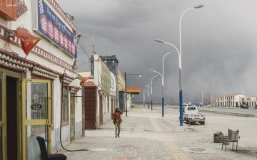
The Yellow River is to the Chinese what the Nile is to Egypt—the cradle of civilization—its 5,000-year civilization started along its banks, and it is often simply known as the "mother river." Water has always been scarce here, a situation exacerbated over the centuries as each era provides new technology to extract more from less. While this generally means productivity has been on an upward trend, it also signifies a march towards an ecological precipice—four-fifths of China’s water is in the south, while half the people, including its heavy industry and two-thirds of the farmland, are in the north.
In 1997, the river stopped reaching the sea for months due to overuse and heavy pollution. Sanjiangyuan Nature Reserve, a region the size of Illinois in Qinghai, was created in 2000 as a response to this national alarm. Today, Ngoring Lake, the largest lake in the reserve, has seen water levels rise above its historical average. Officials claim this as proof of the government’s policies being successful, but scientific research suggest the cause to be climate change—an estimated fifth of permafrost covering 80% of the Qinghai plateau has melted.
Following a Chinese research expedition led by independent geologist, Yang Yong, the group returns to monitor signs of desertification discovered at the headwaters last year. This photographic series documents the changing conditions of the environment at the origins of the river and its surroundings further downriver in the Qinghai Tibetan plateau.


