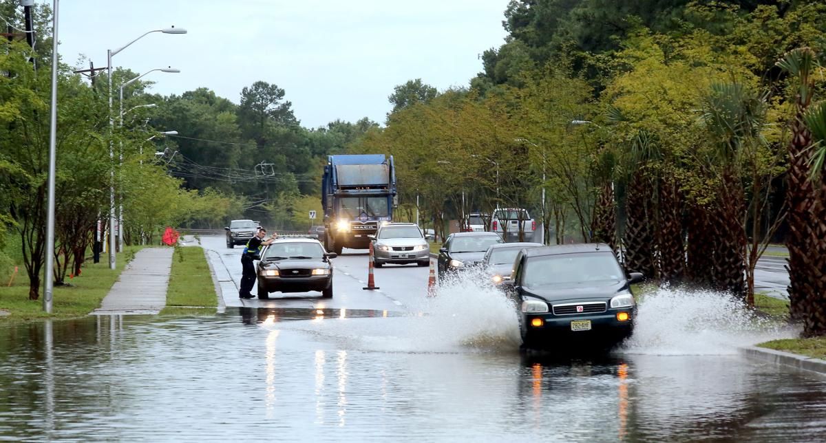
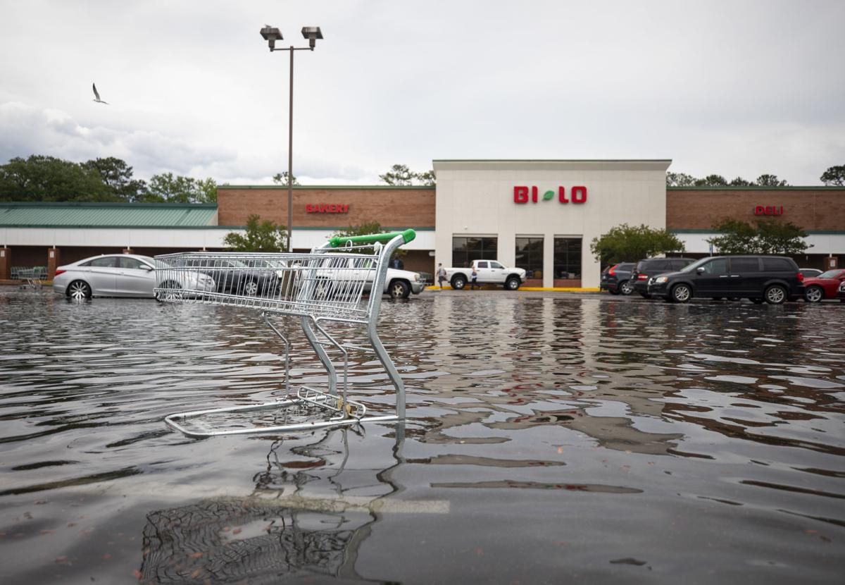
Turbocharged by a warming climate, rain bombs and rising seas swamped the South Carolina Lowcountry this year, sending murky floodwaters into streets, businesses and homes.
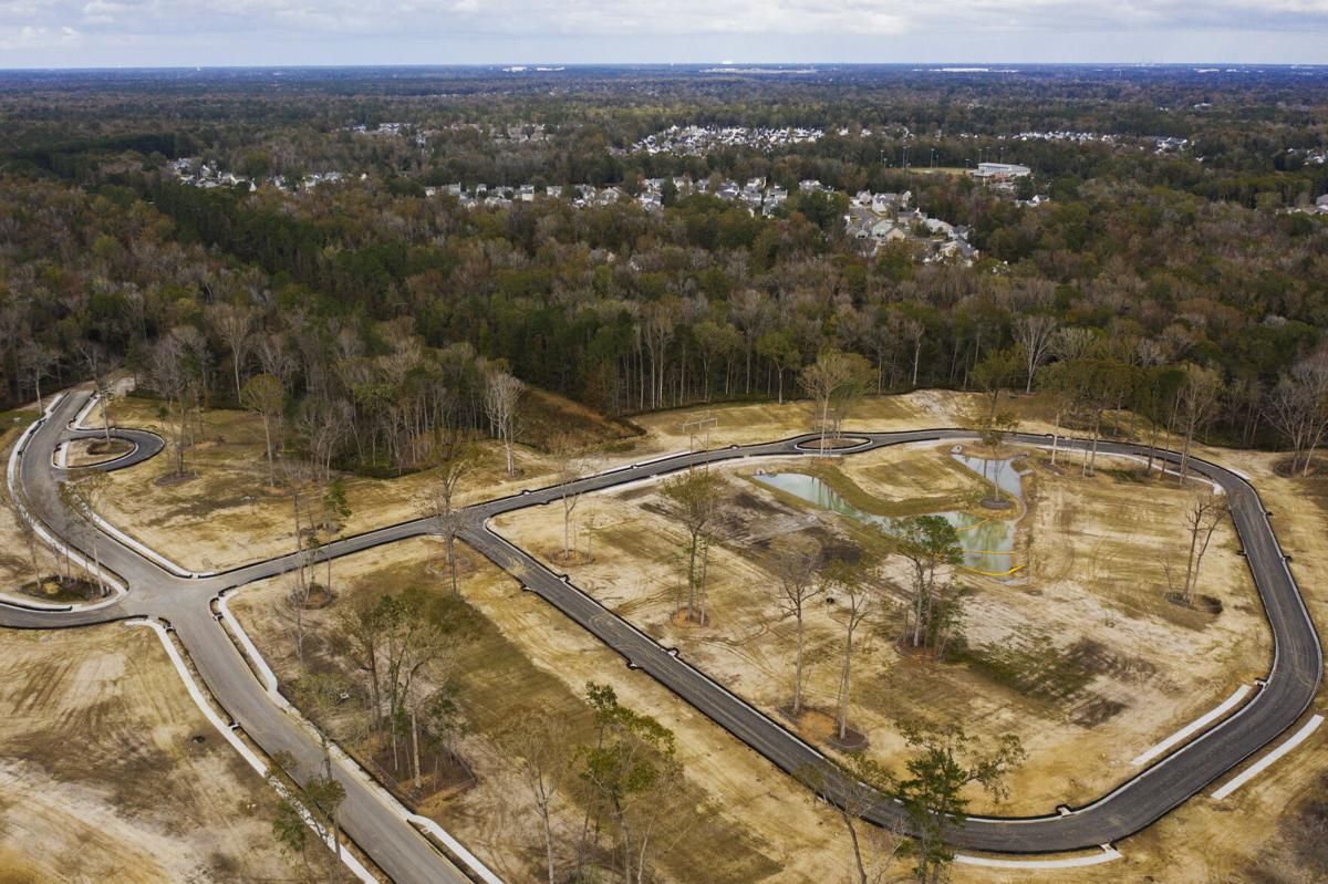
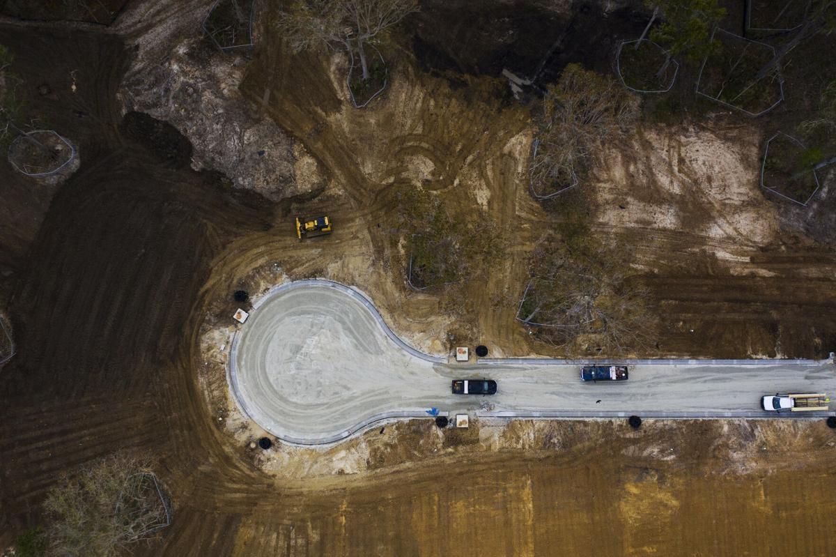
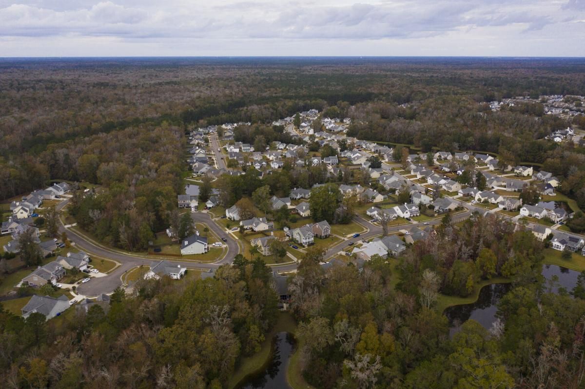
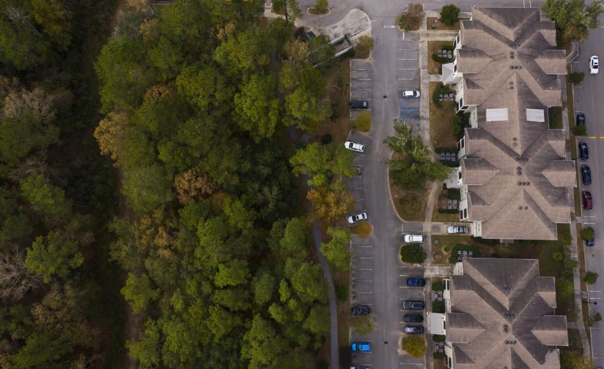
At the same time, developers continue to transform forests and wetlands into even more homes and shopping centers — destroying acres and acres of spongy land that could help sop up these rising waters.
A new analysis requested by The Post and Courier for the Rising Waters project shows how the Charleston area’s unprecedented building boom made us more vulnerable amid the accelerating forces of climate change.
Researchers at the College of Charleston’s Lowcountry Hazards Center used advanced satellite and aerial imagery to measure changes in the area’s tree canopy — a key measure of the land’s ability to naturally manage flooding rains.
What emerged is among the most nuanced looks yet at how our land has changed in recent decades, a powerful new tool for residents and planners alike.
Here’s what they found:
- Charleston County lost about 10,800 acres of tree cover since 1992, an area larger than the Charleston peninsula and Daniel Island combined.
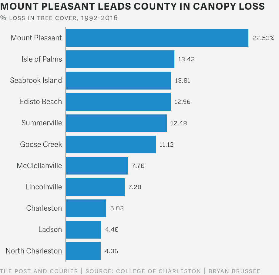
- Some areas lost more than others. A booming city of Charleston lost 5 percent of its tree canopy. North Charleston saw a 4 percent drop.
- Mount Pleasant, the region’s growth leader, lost 22 percent of its tree cover.
- Other tree-loss hot spots include West Ashley neighborhoods off Bees Ferry Road and the Glenn McConnell Parkway and North Charleston neighborhoods downstream from the Palmetto Commerce Parkway.
-
A few places had more tree cover, especially older subdivisions on James Island. But these urban forests shade sidewalks, driveways and roofs — hard surfaces that funnel stormwater into ditches and drains. They don’t make up for the loss of natural forests and wetlands.
“The big takeaway is that you’re seeing more water run off the surface that used to be going into the ground and pumped into the trees,” said Norman Levine, director of the Lowcountry Hazards Center.
The Charleston metro area’s shrinking tree canopy is part of a national crisis. In 2018, the U.S. Forest Service estimated that American cities were losing 36 million trees a year, a massive reduction in greenery that makes cities hotter and less healthy.
And in coastal South Carolina, tree losses are happening when we need these natural stormwater pumps more than ever. A rapidly warming planet fuels heavier rains and higher tides. This year to date, we’ve had 64 tidal flooding events, the second-most on record. Monday morning’s expected 7.5-foot high tide could increase this tally, flooding low spots during the height of rush hour.
The new Lowcountry Hazards Center analysis also helps explain a surge in anger among flood-weary property owners. They say their elected leaders and planning commissions failed them. They’re furious about storms that forced them from their homes in North Charleston’s Pepperhill area, how floods sent stormwater coursing into living rooms of Central Park Road on James Island — even prompted a pastor in West Ashley to grab a kayak and paddle in his flooded church.
But the study’s findings also point toward solutions, ones that would simultaneously preserve the Lowcountry’s beauty and strengthen our ability to take a storm’s punch.
To view an interactive map showing changes in tree canopy cover in Charleston County since 1992, click here. Data provided by the College of Charleston's Lowcountry Hazards Center.
Nature’s Umbrellas
On April 23, clouds built over Charleston, darkening the massive live oaks in Cannon Park. The rain fell that afternoon, and the trees acted like umbrellas at first, catching and holding raindrops in their giant limbs. Then the rain picked up. Water pooled on Ashley Avenue by the Medical University of South Carolina. Within an hour, thigh-deep water surrounded parts of the medical district. Nearly 6 inches fell by nightfall.
Trees are impressive water pumps and air conditioners. A mature tree can soak up 40,000 gallons a year. They pump water through their roots, allowing more water from the ground to seep in. Then they release this moisture in their canopies like misting humidifiers, cooling everything around them.
The Lowcountry has its gorgeous live oaks, with their great elephantine limbs. It has stout pecan trees, pines and cypresses — a canopy that covers about 44 percent of Charleston County, the Lowcountry Hazards Center analysis shows. That compares with 47 percent for Charlotte, a city known for its lush tree canopy.
At first glance, our countywide tree canopy looks stable, with a tree cover loss of 2 percent since 1992. This is the case despite Charleston County’s rapid growth — from about 295,000 residents in 1990 to 405,000 in 2018, a 38 percent increase.
But this stability masks a deeper story, Levine said.
A 2 percent loss equates to about 10,800 acres or 8,200 football fields.
Mount Pleasant’s 22 percent drop was the most of any municipality. But Levine said he wasn’t surprised. The losses coincided with the town’s rapid growth. After Hurricane Hugo hit in 1989, developers hopscotched north along U.S. Highway 17 toward the Francis Marion National Forest. Mount Pleasant’s population in 1990 was about 31,000. Today, it’s 90,000.
During this boom, the complexion of our tree canopy changed, said Levine, a professor in the college’s geology department. Vast swaths of water-slurping open forests were converted into less-thirsty urban forests.
“When you look under the canopies of trees in an urban forest, you see impermeable surfaces like sidewalks and roads,” he said. “All of our tree ordinances and planting efforts have helped, but they haven’t offset the impervious surfaces we’ve created.”
In addition to Mount Pleasant, neighborhoods off Bees Ferry Road and the Glenn McConnell Parkway also saw dramatic changes — with tree losses exceeding 35 percent in some areas.
These places flood often now, a problem that a pastor knows too well.
A Church Investigates
On May 20, another fierce storm hit Charleston, including Bees Ferry Road.
The road once seemed far away from the center of Charleston, but is now a busy suburban thoroughfare. It slices through a watershed called Church Creek Basin and a larger area known as Bear Swamp.
Paul Rienzo is pastor of Crosstowne Church. Bostonian by birth, he moved to Charleston 37 years ago. His church sits in a dip off Bees Ferry Road, not far from Church Creek. Though it’s in a low spot, he thought it was safe from flooding. “It didn’t even flood in Hugo,” he said.
But in 2015, the remnants of Hurricane Joaquin brought a lumbering storm, one that dumped 2 feet of rain on Charleston and Mount Pleasant. Off Bees Ferry Road, floodwaters poured into the church. Rienzo grabbed his kayak and paddled inside to save the sound equipment. At the time, then-Gov. Nikki Haley called it “a thousand-year storm.” But floods came again in 2016, 2017 and 2018.
Rienzo wondered why it was happening so often. Was it just chance? “Something had changed,” Rienzo said. The church hired their own hydrologists and engineers, who made a startling discovery.
Joshua Robinson was lead investigator. He runs Robinson Design Engineers in Charleston and Asheville and teaches at the College of Charleston. Their first priority was to get a better handle on the area’s hydrology — how Bear Swamp collected and released water. And they found clues in a nearby forest.
The U.S. Forest Service had done extensive research in the Francis Marion National Forest, the bulwark of green north of Mount Pleasant. Robinson had assumed that when rain fell in the forest, stormwater flowed out via its many creeks and rivers. But Forest Service scientists found something else was going on.
In this flat landscape, about 70 percent went back up into the skies, mostly through the forest’s trees. “It seems so obvious,” Robinson said in retrospect. “You look at one fully grown tree and how much water it needs.”
In a low-lying area, forests and wetlands had evolved into highly efficient pumps. Pines and oaks and cypresses pumped water from the ground through their roots, which allowed even more water to enter the soil and drain faster. Then the forests released the water through their leaves and needles in a process called evapotranspiration. With their many needles, pine trees were especially efficient water collectors.
Robinson was amazed: “Forests return 7 out of every 10 inches of rain to the atmosphere.”
But as Robinson and his colleagues studied changes in Bear Swamp, they saw how developers and governments had built ditches to guide stormwater toward the Ashley River, and ultimately, the Atlantic. Water flowed faster through the basin. These growing pulses of water overwhelmed ditches and Church Creek. At the same time, some of the ditching allowed tidal water from the Ashley River to flow inland.
“This landscape and its soils formed over eons, and then in a small timescale, a matter of decades, it was turned into rooftops, pavement, more ditches,” Robinson said. Area governments had allowed this development “without an awareness — or the tools to understand the power of these actions.”
For Robinson, it was a eureka moment: The Lowcountry’s forests and wetlands were amazing pumps; if you got rid of them, stormwater flowed faster through the area. Flooding got worse, requiring more ditches and pipes, a cycle of failure.
He finished the study thinking that the forests and wetlands in Church Creek Basin and elsewhere “should be preserved at all costs.”
The Stormwater Detective
Storms this year hit James Island especially hard, and each time, Jimmy “Zeke” Mazyck knew what would happen.
He’s a retired firefighter who moved to a neighborhood off Central Park Drive about 21 years ago. This area grew rapidly in the 1960s and 1970s as once-rural James Island became a suburb. It has a thick “urban forest” canopy as trees matured after this early burst of development. But the Lowcountry Hazards Center analysis found it has still lost about 9 percent of its tree cover since 1992.
Mazyck said flooding wasn’t a problem until 2006. That’s when a new pulse of home and apartments hit the area: apartments and subdivisions that replaced some of the remaining open forests.
Since then, floodwaters have flowed into his house over and over. He ripped up the wooden floor and installed water-resistant tiles. The water would come and go, but his anger and confusion rose with each flood.
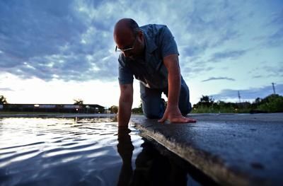
During the April 23 drenching, he pulled out his kayak and paddled down the street. He watched the floodwaters run through his shed. He waded in waist-deep water to clear blockages in the ditches. He wedged foam rubber in his doors to keep as much water as he could from getting inside. He vacuumed water that did make it in with his carpet machine. He dumped the fluid into the bathtub until the sewer system backed up. Why was it getting so bad?
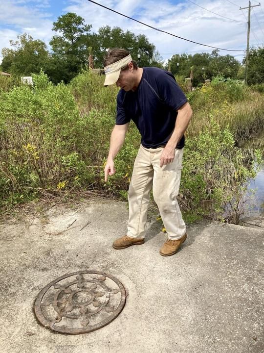
His neighborhood is about half a mile from Charleston Harbor. Stormwater ditches line the streets and connect to capillaries of creeks that feed the Stono and Ashley Rivers. He traced the ditches. Near EME Apartments, he found three pipes converged like a road intersection into a concrete box that fed a tidal creek. But water left the box through just one pipe.
Something clearly was off — three pipes going in, one going out. He opened a manhole cover and went into the box. That’s when he discovered a second 48-inch pipe had been sealed with concrete. The city has no permits that allowed the pipes to be filled, and aerial photos suggest that it likely happened around 2006. What’s clear is that one clogged pipe had caused water to back up in his neighborhood.
That plumbing mistake was bad enough, he said. But he and his neighbors already were furious about plans for new subdivisions on four mostly forested tracts. All told, they will add nearly 200 new homes and townhomes to an area that already can’t handle moderate storms.
Desperate and feeling unheard, neighbors hired a consultant, Steven Emerman, a hydrologist who has testified before Congress and once lived in Charleston.
Emerman documented 22 flooding events on James Island during the past five years. He agreed that Mazyck had discovered a chokepoint.
The city is working on a $4 million drainage project for the area, one that will fix that chokepoint. But it will take at least three years to do it, said Matt Fountain, the city’s stormwater management director.
Meantime, construction crews recently cleared trees for a 30-lot development off Fleming Road. A second project with potential for 146 townhomes could go on 28 acres of tree-covered land just upstream from the chokepoint Mazyck discovered.
In a community meeting, Emerman called it “the most ill-considered development project I’ve ever encountered. … Just stop it. Stop taking a bad flood situation and making it worse.”
Grand Trees Gone
Some of the best rainwater collectors are grand trees — large, old trees such as Angel Oak on Johns Island. Its limbs shade 17,000 square feet, equivalent to roofs of five sizable homes.
Since 2015, the city of Charleston has issued 1,205 permits to remove grand trees, city officials calculated in response to a Freedom of Information Act request. A grand tree has a trunk with a diameter of 24 inches or more. Line up all those missing trees, and you would have a tree wall stretching for half a mile.
At the same time, the city planted more than 1,400 smaller trees every year, a number that doesn’t include trees planted on private property.
This helped the city keep its tree canopy from declining more, Levine said. But mature trees are much better collectors of stormwater than saplings and young trees, he and other experts said.
In 2017, the city hired a consultant from Virginia, the Green Infrastructure Center, to analyze the city’s tree canopy and its impact on stormwater. The group came up with some startling calculations: During a heavy downpour, the city’s trees suck up 569 million gallons of water in one day — enough to fill at least 860 Olympic-size swimming pools.
The group also created a tool that calculates how reducing tree cover increases stormwater flows. For example, if the city’s tree canopy shrank by 10 percent, that loss would increase runoff by 208 million gallons. Conversely, a 4 percent increase in the tree canopy could capture 88 million gallons of runoff.
The group also saw plenty of mistakes. Developers brought in dirt to raise swampy land. Builders created pits with trees in the middle, a practice that likely will kill those trees over time, Karen Firehock, executive director of the Green Infrastructure Center. “I also saw a lot of developments had been built in and around forested wetlands, and those wetlands aren’t doing well.”
The group offered 17 recommendations. High among them was a goal to increase the tree’s canopy. So far the city has yet to set one.
The group also suggested that area leaders form a tree-advocacy nonprofit, a successful approach in other cities.
The city’s response?
“Crickets,” Firehock said.
A City Is Saved
In 2018, Hurricane Florence slow-walked through the Carolinas. Loaded with moisture, it fit the pattern of climate-driven storms: an unusually intense system that holds massive amounts of moisture and then unloads it in a biblical way. It dumped 13 trillion gallons over the Carolinas, 2 feet of rain in places. It fell on watersheds that led to Georgetown. The city braced for a devastating flood. Then something unexpected happened.
Great volumes of water filled swamps and forests upriver. This land behaved like a giant sponge, holding the water and releasing slowly. Scientists with the state Department of Natural Resources later calculated this sponge held a volume akin to all the water in Lake Marion.
Georgetown was spared.
It was a dramatic example of how forests and wetlands protect us, said Maria Whitehead, senior project manager for the Open Space Institute, a group that protects land. The institute calculated that every dollar invested in protecting flood-prone open space saves $5 in reduced impacts to homes and businesses.
In the past, groups such as hers “focused on protecting nature for nature’s sake,” she said. “Now this is about protecting nature for humans’ sake.”
Planting more trees and protecting open space are two ways to reduce the effects of rising seas and drenching rains, she and experts say. Levine, director of the Lowcountry Hazards Center, has seen firsthand how a single tree can make a difference.
He lives West of the Ashley, not far from the marsh. He had a large water-sucking wisteria vine in his backyard that irritated his neighbor. After he cut it down, the area suddenly got soppy. Then his neighbor planted a willow tree and some shrubs, and the flooding stopped. “The power of plants,” Levine said.
