With each passing year, South Korea's inhabited islands in the Yellow Sea look less idyllic and more like a war zone.
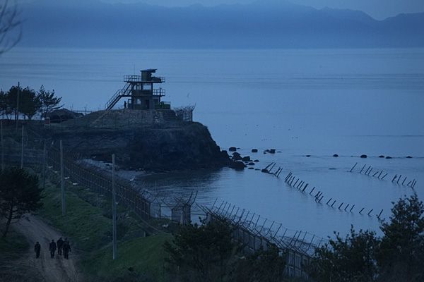
On Baengnyeong Island, South Korean marines can be seen digging fresh trenches and stacking sandbag fortifications. A collection of newly constructed bunkers stand ready to shelter islanders if North Korea unleashes an artillery attack.
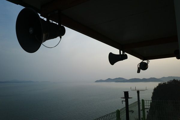
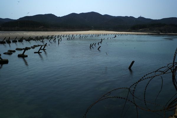
Just before dusk on Wednesday, I watched a patrol of marines make their way along the island's northern shore. The sea was calm and the air warm, but successive banks of anti-ship spikes and a long stretch of razor wire had altered the natural beauty of the beach. After dark, I spotted two Cobra attack helicopters with no lights skimming over the island.
Located only 13.4 km (8.3 miles) off the coast of North Korea, and geographically closer to Pyongyang than Seoul, Baengnyeong Island is the most isolated and exposed location within the disputed Yellow Sea boundary separating the two Koreas.
When the 1953 ceasefire agreement which ended the Korean War was drawn up, it put Baengnyeong and four other Yellow Sea islands under southern control, but the negotiating parties failed to specify a sea border between them. At the time, it was assumed that the minimal ceasefire document would soon be replaced with a comprehensive peace treaty.
Nearly 60 years later, no peace treaty has materialized. The southern side, under the United Nations Command, drew a boundary between these Yellow Sea islands and North Korea's coast. The point where ships from the South are not authorized to cross is called the Northern Limit Line. In 1999, North Korea unilaterally announced its own line, extending the DMZ land border—which roughly follows the 38th parallel—out into the sea. The line is far to the south of the UN Command line, and more importantly, it is also south of the five Yellow Sea islands, leaving the islanders surrounded by water which is claimed by their enemy.
Since 1999 most military incidents have happened in the disputed zone between the two lines, and more incidents are likely to happen here again in the future.
2010 saw two of the most serious incidents—in terms of military and civilian casualties—since the end of the Korean War.
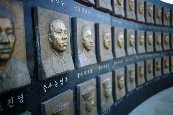
In November 2010, North Korea shelled the island of Yeonpyeong with heavy artillery, killing two civilians and two South Korean marines and wounding 44 others. North Korea admitted the attack, calling it retaliation for joint U.S.-South Korean military exercises inside the disputed sea boundary. Today, most of the houses that were shelled or destroyed by fire have been rebuilt on Yeonpyeong, but a few people are still living in temporary government-provided shelters.
On March 26, 2010, the South Korean corvette ROKS Cheonan split in two and sank, killing 46 sailors. The official report from the South Korean-led investigation states that the cause of the sinking was a torpedo fired from a North Korean mini-submarine. However, the South Korean government has a major credibility problem since releasing the report—having backtracked on statements during the investigation and apparently contaminated key evidence. Unlike the later artillery attack on Yeonpyeong, North Korea denied responsibility for the Cheonan sinking. Without overwhelming evidence of the cause, a wide range of alternative explanations of the sinking has been put forward, some by naval experts, others by conspiracy theorists.
Multiplying the uncertainty are the two rowdy political camps in democratic South Korea, with the right wing regularly accused of exaggerating the communist threat from the North to scare voters, while the left wing routinely turns a blind eye to human rights violations and military provocations in the hope that a consistent nonjudgmental stance toward the North will one day lead toward talks and unification.
Unfortunately, neither the Sunshine Policy of the previous left-wing administration, nor the hard line stance taken by the current right wing government has been able to turn North Korea into a more agreeable neighbor. For all the maneuvering between the political parties, South Korea's various policies toward the North don't seem to have much of an impact. Nor has U.S. policy after decades of trying multilateral talks, special envoys, aid packages and sanctions. The latest U.S. tactic seems to be to ask China to pressure North Korea. Assuming that Beijing can willingly influence Pyongyang's actions seems highly optimistic in the light of the Kim regimes’ proven capacity to resist.
With little hope of taming Pyongyang diplomatically and no negotiated resolution to the disputed sea boundary in sight, the only thing left which can protect the Yellow Sea islanders are even more bunkers and fortifications.


