The intensive and prolonged rainfall in Uganda and East African region has caused a rise in water levels of Lake Victoria and all major water bodies in the country.
Recognizing that many parts of Uganda, including Lake Victoria, received above normal rainfall between mid-April to late June 2020, water levels have risen further, resulting in floods with severe effects around the country.
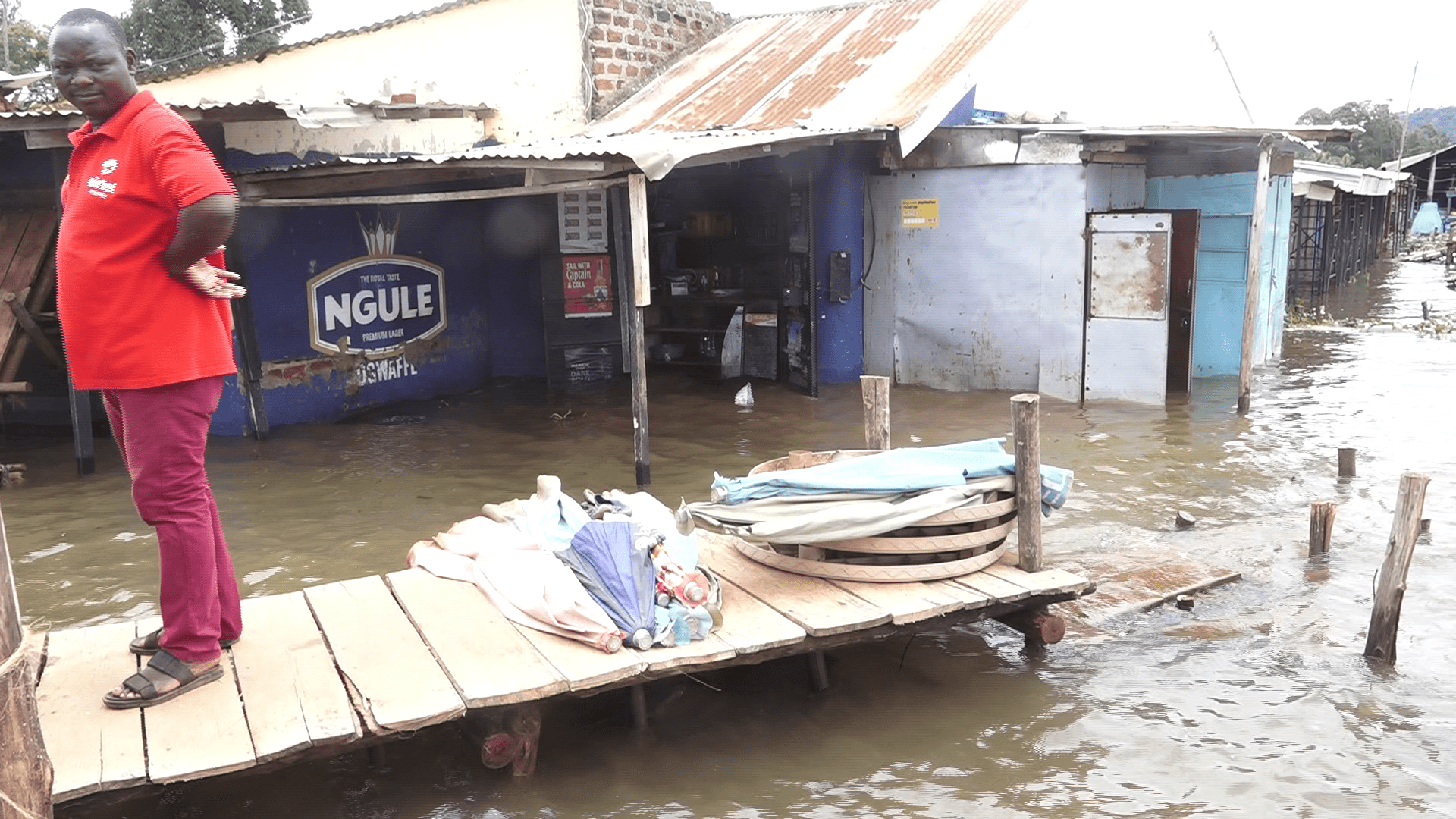
At Ggaba landing site located north of Lake Victoria and Port Bell, a small industrial centre in the south of Kampala, life and settlement have been disrupted by the flooding water that has submerged the areas.
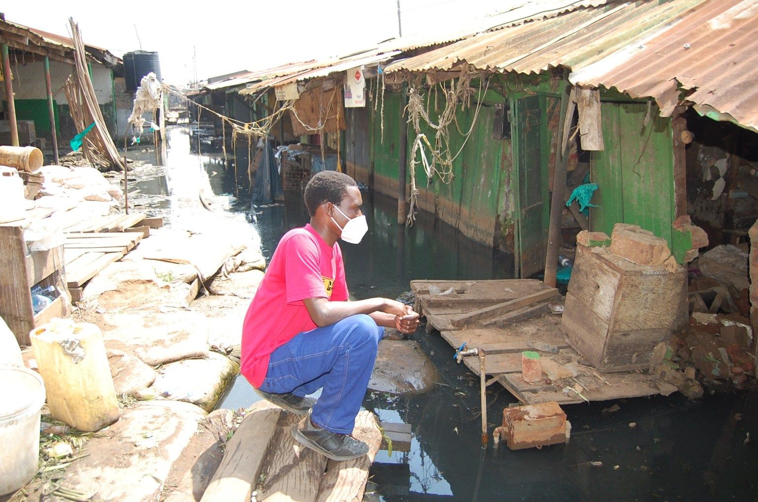
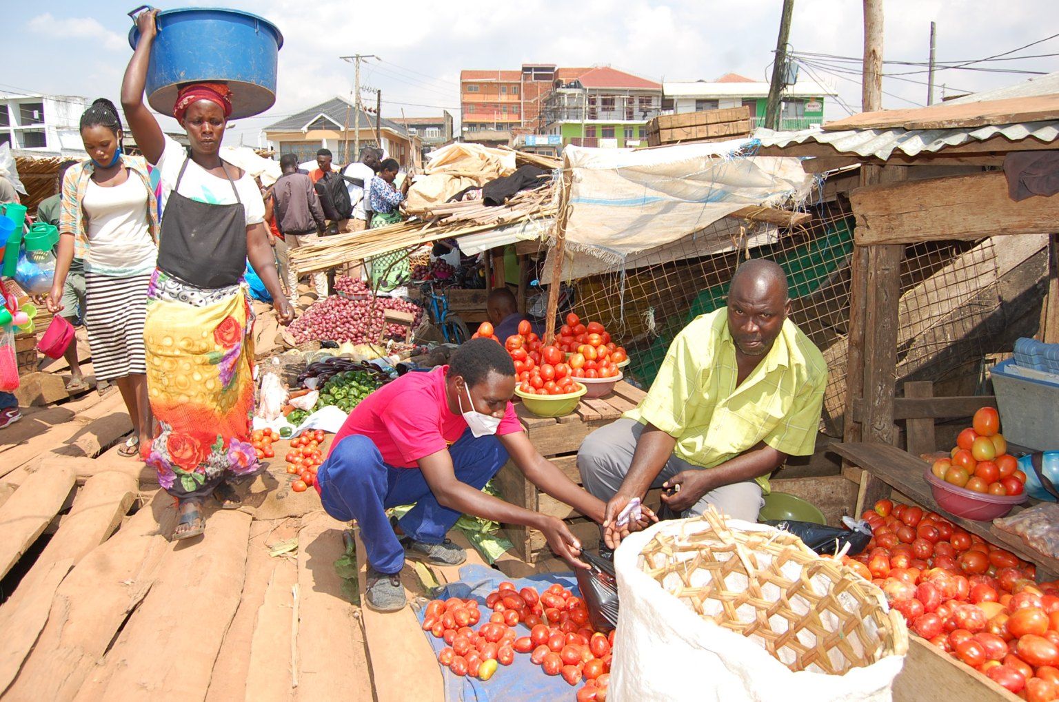
Places such as Ggaba and Port Bell markets have all been submerged by water, and traders have resorted to selling food and other items on the road that leads to the markets. Similarly, happening places such as Ggaba Beach, K.K. Beach, and Miami Beach have been swallowed by water. Other establishments that have been affected are Ggaba Water Works offices, Serena-Kigo Hotel, Speke Resort Hotel-Munyonyo, and several others surrounding the great waterbody.
The question on most people’s minds when they see flooded markets, homes and businesses on the shores of Lake Victoria is whether the beaches, landing sites, and some islands they have known all their life will resurface.
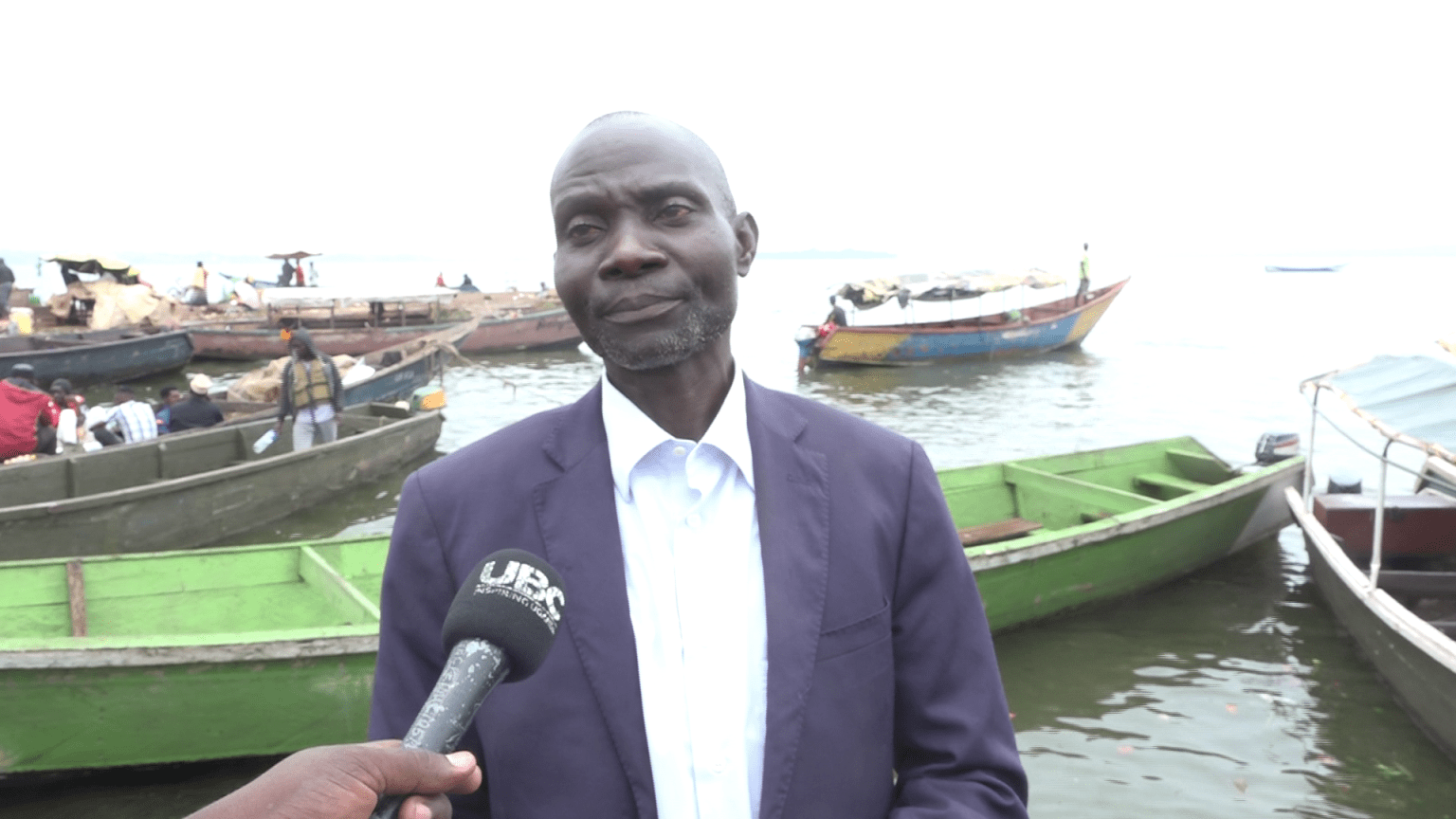
Standing at the flooded part of Ggaba landing site was Kassim Katende, the chairperson of the fishermen at Ggaba.
“Most of the community members here depend on fishing, but right now we do not have fish because the lake is full of water and security forces are guarding the waters,” lamented Katende.
Sarah Kaine, a businesswoman who sells food items, expressed her fears for her dying business because of the flooding in the area.
"Our customers have disappeared and we are worried that we may not be able to continue with our business again. My selling point has been flooded and I have no other option but to wait until it dries up,” Kaine said.
Mzee Sulaiman Kassujja, a trader dealing in fish selling at the same landing site for the past 25 years, said that “we who sell fish are affected so much because fishermen no longer catch good fish and in large quantities. The few fish caught are very expensive.”
According to Sulaiman, the rise in the price of the fish has made their customers opt for other substitutes such as meat and chicken. He further noted that the rise is also a result of the challenge in accessing the catch from the lake, along with increase in costs due to the COVID-19 lockdown.
Currently, a big tilapia goes for UGX 35,000 ($9.21), up from UGX 20,000 ($5.26), the price before the disaster outbreak.
Hamis Gamwero, the LC1 for Ggaba landing site who has lived in Ggaba for four decades, said, “Since I came here in 1986, I have never seen this kind of flood. The people, especially traders, are at a high risk of contracting other diseases, and it is worse that we have coronavirus.”
Kamadha Kakooza, the Katoogo Village chairperson, told us that at least 500 families have already left the place, and hundreds, who have been rendered homeless, have been accommodated in other peoples’ homes that are yet to be invaded by the overflowing water.
“When the water levels started rising, those who could chose to vacate the area. Some [who had nowhere to go] remained. What we did was to talk to those who are yet to be affected to at least accommodate those affected for some time,” he said.
Meanwhile, at Port Bell in Luzira, which is also a rail link and a railroad ferry wharf used for International traffic across Lake Victoria to Tanzania and Kenya, the story is no different. The water has entered into houses of the dwellers and forced them to seek refuge somewhere else.
“People are trying to desilt the water by pouring sand but the environment authorities are against it,” said Teopista Nankinga, a women’s leader at Port Bell.
Markets and settlements near the lake have severely been affected and homes submerged by the flooding water. The disaster has also been recorded at the same time when the country is under lockdown in March because of COVID-19. This means that the affected people are left with a few options for survival since most of them could not travel to their villages.
Many of the businesses and government installations flooded were located outside the 200-perimeter buffer zone recommended by the government. Their destruction raises tough questions about the level of government planning. If the buffer zone recommended by the government is not safe, what is safe? Suppose businesses move farther away from the expanded lake shore — what happens when the lake shore eventually recedes?
The continued downpour and flooding has had negative impacts on the people and property downstream of Lake Victoria during the time when the country and region at large is on a lockdown, as a means of controlling the potential spread of coronavirus.
Environment experts warn that the flooding of the lake tributaries has been accelerated by environmental degradation, which has caused a disruption of the water bodies.
Dr. Daniel Babikwa, the District Support Coordinator at the National Environment Management Authority (NEMA), said that the communities encroached on the shores of the lake, thus disturbing nature.
“Unfortunately, many people encroached on the shoreline and what you see now are the results of the impact,” said Babikwa.
On the same note, Beatrice Anywar, the Uganda State Minister for Environment, told Aica that most of the structures including beaches set up around the lake were illegal.
The minister revealed that the government is encouraging voluntary migration of the settlement away from the endangered zones of the lake shores, and warned that action will be taken against those who will not leave.
In the same call, Dr. Tom Okurut, the Executive Director for NEMA, advised the affected residents to vacate the natural habitats lest they will be forcefully evicted.
A statement issued by the Ministry of Water and Environment on 1st May stated that the Lake Victoria water level continues to rise to critical levels, despite increased releases, due to the increasing inflows and heavy rains in Lake Victoria Basin. This is partly because the rivers discharging into Lake Victoria from upstream countries have more than doubled their inflows.
The current water levels that started last October (2019), have consistently continued to rise up from 12:00 meters to the current 13:32 meters, the second highest increase recorded since 1964, when the water level rose to 13:46 meters.
What caused the water level rise?
Sam Cheptoris, Uganda’s Minister for Water and Environment, explained that Lake Victoria has over 23 rivers flowing into it from the three East African countries that include Kenya, Tanzania and Uganda.
According to the minister, when it rains, an increase in the waters from those rivers results in the direct increase in the water they pour into the largest freshwater lake in the continent.
“Some of these rivers originate from as far as Rwanda and Burundi: therefore, when it rains in those countries, water finds its ways into Lake Victoria,” explained the minister.
Cheptoris further noted that “a number of areas around lakes and rivers have been identified as high flood risk areas and essential features such as schools, health facilities and places of worship are at risk.”
Is the government taking any measures?
In a communication by Minister Cheptoris, the government has put into place a number of measures to help address the problems of the rising water levels and associated floods.
Government has since instituted measures to immediately reduce the water levels of Lake Victoria through increased releases at the dam in Jinja. Water is currently being released at the rate of 2200 cubic meters per second, up from the rate of 1000 cubic meters per second in October 2019.
A national response team has been formed, comprised of the Ministry of Works and Transport, Ministry of Energy and Mineral Development, Ministry of Defense and Veteran Affairs, Ministry of Agriculture, Animal Industry and Fisheries and the Ministry of Water and Environment. The team has ready equipment and machinery to carry out surveillance and monitoring of the movement of the floating islands of the water hyacinth, which blocked the dam in Jinja leading to a nationwide power outage in May. This team removed the floating islands that were considered a threat to the electricity power generation.
An Inter-Ministerial committee has also been set up under the Chairmanship of the Prime Minister, comprised of 14 ministries and seven agencies, to implement the government’s response to the disaster.
A multi-sectoral technical task team chaired by the Ministry of Water and Environment is also providing support to the Inter-Ministerial Committee and has already started on emergency works to ensure safety of the hydropower dams, protect lives, and monitor the water resources and floating islands.
At the time of compiling this report, the lockdown in the country was preventing people from using public means of transport. Some businesses such as salons, bars and open access markets were restricted from operation – potentially putting the survival of the affected people at stake.
Lake Victoria, which is shared by three countries: Tanzania (49%), Uganda (45%), and Kenya (6%), hit 1,134.38 meters above mean sea level (mamsl) on May 7.
The swelling of Lake Victoria has been caused by increased rainfall and a spike in runoff into rivers and streams that feed the lake, originating from countries such as Rwanda and Burundi along with the three countries that border the lake: Kenya, Uganda and Tanzania. Runoff has risen due to heavy rainfall combined with urbanization and agriculture, as humans convert land that naturally absorbs water, such as forests and wetlands, to cities or farms.
Data from the UN-run Flood and Drought Portal shows that runoff in all four sub-regions bordering Lake Victoria increased 575 percent in the last four months of 2019 compared to the same period in 2018.
Rainfall in the regions surrounding the lake also increased 162 percent from September to December 2019, compared to the same period the year before.
A climate change simulation on the same portal showed that rainfall in the Lake Victoria region is expected to rise by about 10 percent in the next 16 years compared to the last 16. More drastically, runoff in this region is expected to rise by almost 60 percent. This includes a 50 percent projected increase in runoff in the Kenya region bordering the lake and a 128 percent projected rise in much of eastern, central and western Uganda. Runoff in the Kagera region of Rwanda, Burundi and Tanzania, which contains Lake Victoria’s main feeder river, River Kagera, is also expected to rise by about 50 percent.
Lake Victoria lies on an average elevation of 3,720 feet (1,134 meters) above sea level. Kampala is just 1,200 meters above sea level, a difference of about 70 meters. Ggaba, which is 60 meters above at 1,140 meters above sea level, is already inundated.
If the current rate of rise in water levels were to continue, the State House in Entebbe and Parliament of Uganda in Kampala could easily be submerged.
This story was produced in partnership with InfoNile with support from Code for Africa and funding from the Pulitzer Center and National Geographic Society. Additional reporting and editing by Annika McGinnis.


