Story

Tracing North Korea's Borders

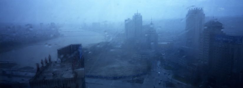
Buildings are seen through a storm in Yanji, China. The city of Yanji is a major hub for North Korean escapees and defectors. Image © Tomas van Houtryve/VII. China, 2013.

Two trains wait on the platform at the railroad station in Dandong, China. Dandong is the main station for trains going into North Korea. Image © Tomas van Houtryve/VII. China, 2013.

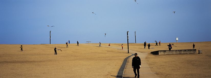
A man with a Korean War veteran's hat walks through a park where children are flying kites at Imjingak, Paju, South Korea. Imjingak is the closest area where civilians can go to the DMZ and the North Korean border without special permission. An observatory, monuments, and a park have been built to console people separated by the frozen conflict on the Korean peninsula. Image © Tomas van Houtryve/VII. South Korea, 2013.

The "Peace Dam" in Hwacheon, South Korea. The preventive dam was built 35 km downstream from North Korea's Imnam Dam, which is seen as a threat that could kill thousands of people in South Korea if the water held back by the dam was suddenly released by accident or as a deliberate attack by the North Koreans. In 2005, South Korea completed the construction of the Peace Dam, at a cost of $429 million, to protect downstream populations from a potential flood from the North. So far, the risk remains hypothetical and and dam's reservoir is empty. Image © Tomas van Houtryve/VII. South Korea, 2013.

A small rowboat used by a scrap smuggler is seen inside North Korea, beyond razor wire from the Chinese side of the border near Dandong, China. North Korean soldiers and workers were observed loading scrap metal into the boat before it crossed the Yalu river to the Chinese riverbank at an illegal crossing point. Image © Tomas van Houtryve/VII. China, 2013.

South Korean marines sleep in the ferry boat to Yeonpyeong Island in Yellow Sea, off the Korea peninsula. In Nov. 2010, North Korea launched an artillery attack on Yeonpyeong Island, killing four South Koreans and leaving 19 injured. When an armistice ended open conflict on the Korean peninsula in 1953, there was no agreed upon sea boundary between the two Koreas. Each side has drawn its own line, the South Korean controlled islands of Yeonpyeong, Baengnyeong and Daecheong are located between the two disputed lines. Image © Tomas van Houtryve/VII. South Korea, 2013.

A North Korean soldier stands guard atop a concrete barrier along the Yalu river inside North Korea, facing the Chinese border near Dandong. Image © Tomas van Houtryve/VII. China, 2013.

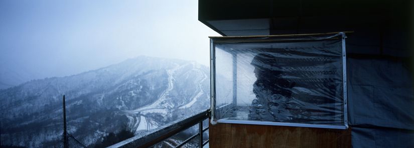
A South Korean soldier looks over the DMZ from a guard position on top of Observation Post 717, on the edge of the North Korean border near Goseong, South Korea. Image © Tomas van Houtryve/VII. South Korea, 2013.

South Korean special forces soldiers crawl through cement tunnels during winter training drills in Pyeongchang-gun, South Korea. The South Korean commandos train in the snow and extreme cold weather conditions to maintain readiness for a possible war with North Korea. Image © Tomas van Houtryve/VII. South Korea, 2013.

Attack warning sirens are seen near a guard post overlooking the Yellow Sea on Baengnyeong Island, South Korea. When an armistice ended open conflict on the Korean peninsula in 1953, there was no agreed upon boundary in the Yellow Sea between the two Koreas. Each side has drawn its own line. The South Korean-controlled islands of Yeonpyeong, Baengnyeong and Daecheong are located between the two disputed lines. Image © Tomas van Houtryve/VII. South Korea, 2013.

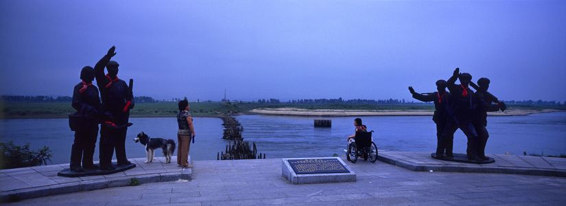
Monuments to the Sino-North Korean alliance during the Korean War mark the Chinese riverbank of the Yalu River at a site where a destroyed wooden bridge leads to the North Korean riverbank near Dandong. The Yalu River marks the boundary between the two communist nations. Image © Tomas van Houtryve/VII. China, 2013.

Bright LED lights illuminate a tourist boat and part of the Sino-Korean Friendship Bridge in Dandong along the Chinese bank of the Yalu River, while darkness envelops the city of Sinuiju on the opposite North Korean riverbank. The Yalu river defines the border between the two communist nations. Image © Tomas van Houtryve/VII. China, 2013.

This panoramic series documents North Korea's 870-mile border with China and the DMZ, which separates it from South Korea. These are little known landscapes, where refugees, smugglers, soldiers and spies exist on the fringes of the world's most enigmatic country.